Shapes of Geography
One of the aspects I adore about Montessori is the focus on geography and culture. By exploring geography, we are far better equipped to understand the details of history and current events. My children love having a grasp of where they exist in world.
While we enjoy exploring geography through traditional maps and globes, experiencing geography through a tactile encounter of shape has helped my children internalize various continents, countries and states.
Our work often stems from Montessori wooden puzzle maps, one of my favorite traditional materials. These puzzles are fairly large at roughly 22 by 18 inches. The pieces are durable and precisely cut with knobs that indicate where capitol cities are located. My children haven taken an interest in our puzzle maps from the earliest moments of primary and they will be used for many years to come.
We enjoy using them as basic puzzles. Here you can see my son working with our puzzle map of Europe.
But the use goes far beyond that. Here are few additional ways to explore shapes in geography.
When we introduce new land masses, we trace the exterior with our fingers. We often take turns, passing the pieces between us as we name them.
To take it step further, we trace pieces with an object such as the back end of a thin, watercolor paintbrush.
A child with more control can trace the shapes onto paper.
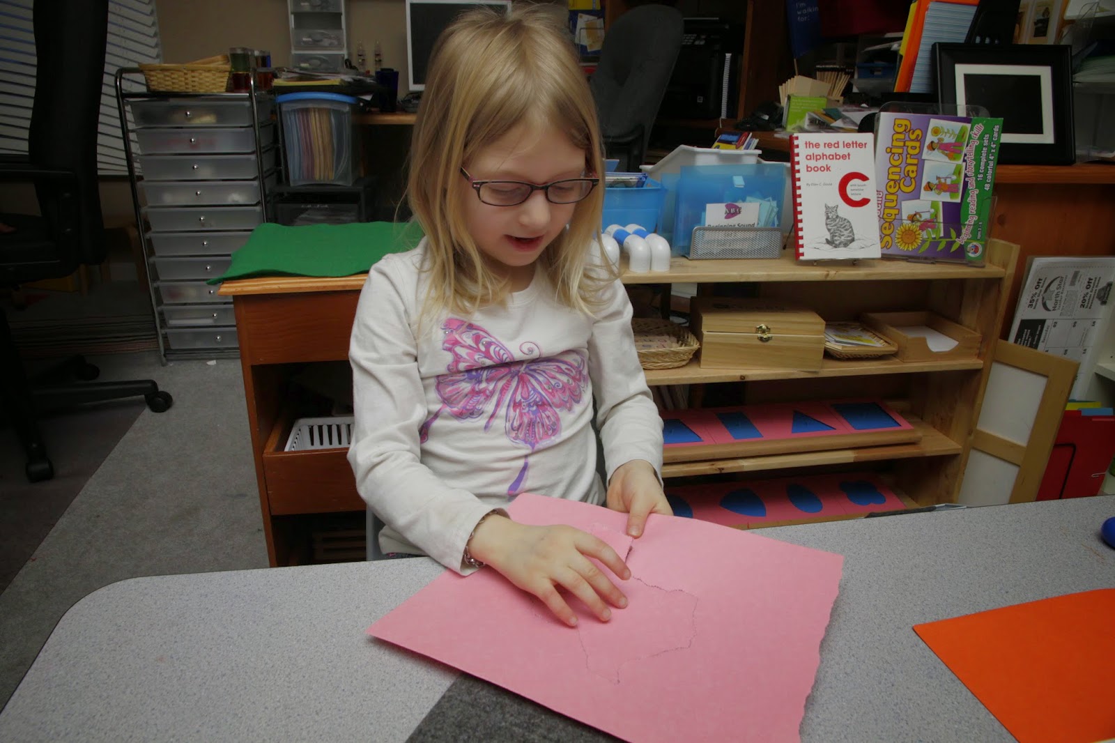
One exploration of geographical shapes unique to Montessori is called pin poking. For this activity, the child uses a poking tool to create small holes along the outline. It is a work that helps develop patience and fine motor control. Once the outline has been punched, you can tear off bits of paper to reveal the shape.
If you're interest in pin poking, you will need the following supplies:
- a thick felt pad
- an outline on paper
- a poking tool*
*You can purchase authentic pin punches from Montessori suppliers such as Montessori Services and Montessori n Such. You can also use jumbo push pins. However, please do not use standard sized push pins as these can be swallowed. There was an unfortunate accident at a Montessori school several years ago so I cannot stress this point enough.
Here is example of my daughter completing a pink poke work of Texas, which she had previously outlined from the puzzle map.
She is storing her state pieces in a folder. Her goal is to create one of each so she can recreate the United States map. This is a classic work in a Montessori classroom. As a simpler work, a child can recreate the continents from the world map.
To highlight how these experiences have benefited us, my daughter chose to draw an outline of Texas from memory. It wasn't perfect but she managed to capture several key features. She immediately whisked it to a special place in her room so I wasn't able to get a picture.
While the puzzle maps are fantastic, it isn't always possible to acquire them. I love one of the exercises my children do at their weekly Classical Conversations community meeting. They use dry erase markers to trace laminated maps. Since my daughter's class is older, they trace individual states. My son's class is focusing on tracing the United States as whole. This is an excellent way to explore the shape of landmasses without the puzzle maps
I hope you enjoy these simple activities to further explore the shape of landmasses in geography.
-Bess
Don't forget to follow me on Facebook and join me at Montessori Homeschooling.
This post is part of the 12 Months of Montessori Series. I am truly honored to be part of this endeavor. I want to encourage you to visit all the participating blogs to learn more about Geography.


No Comment to " Shapes of Geography "